Description
ABOUT THE BOOK
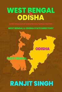
West Bengal state is situated in the eastern part of India stretching from the Himalayas in the North and to the Bay of Bengal in the South. The State came into existence after the independence of India in 1947. It is named so as the state lies in the western part of the undivided Bengal Province with its capital in former Calcutta.
The State has the largest international boundary, which is shared with Bangladesh in the East, Bhutan in the North and Nepal in the North-west. The State also shares Interstate boundary with Bihar and Jharkhand in the West, Odisha in the South-west, Assam in the North-east and Sikkim in the North. Its geographical locations is 21-25-24 to 27-13-15 North Latitude and 85-48-20 to 89-53-04 East Longitude. Its extent from North to South is 623 km and from East to West is 320 km. The area of West Bengal is 88752 sq.km and population is 91276115 as per 2011 census. The principal language of the state is Bengali and the state capital is Kolkata.
At present West Bengal comprises 5 Divisions,23 Districts,66 Subdivisions,341 CD Blocks as well as 16 Rajya Sabha seats, 42 Parliamentary Constituencies and 294 Assembly Constituencies as unicameral.
Odisha formerly called Orissa is an Indian State located in the eastern part of the country on the Bay of Bengal. Its coastline is about 476.4 km long. Odisha was comprised portions of the then Bihar and Orissa Province. It became a separate province on 1 April,1936 in British rule. Before India became independent in 1947, Orissa’s capital was at Cuttack. The present capital of Odisha is Bhubaneswar. In late 2011 the state’s name was officially changed from Orissa to Odisha.
Odisha is located between the parallels of 17-49 to 22-34 North Latitude and meridians of 81-27 to 87-29 East Longitude. Its extent from North to South 1030 km and from East to West 500 km. It is bounded by the states of Jharkhand and West Bengal to the North and North-east, Andhra Pradesh to the South, Chhattisgarh to the West and Bay of Bengal to the East. The principal language of the state is Oria. The area of Odisha is 155707 sq.km and population is 41974218 as per 2011 census.
At present, the Odisha state comprises 3 Divisions, 30 Districts,58 Subdivisions,314 CD Blocks as well as 10 Rajya Sabha seats, 21 Parliamentary Constituencies,147 Assembly Constituencies as unicameral.


Reviews
There are no reviews yet.